![]()

Maptide
 International Standard GIS Software Package
Maptide
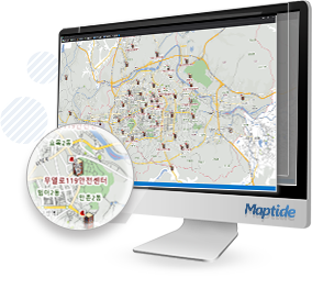
GIS Engine for fast and precise Control and Monitoring of Incidents
- Real-time GIS Server
- Integrated process service to display real-time information
(vehicle location, traffic conditions, etc.) - Data link Service
- Provides link to external entities systems for coordination and operations
- Geo-fence Service
- Configure zones for alarm function and zone control
- Tile Map Service
- High performance and compatibility by Tile Map method
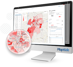
Maptide BImap
Geographic analysis service based on Big Data
- Information analysis and disaster risk with years of data by geographic area
- Various display of geographic analysis results
- Analysis functions of risk zones, compare between zones, statistics areas, type of incident, etc.
Maptide
Maptide BImap
© WINITECH Co., Ltd All right reserved
(Bon-dong, Daegu Technical University, Welfare center 2F), 205, Songhyeon-ro, Dalseo-gu, Daegu, Korea
Tel : 82-53-659-1700FAX : 82-53-659-1707