![]()

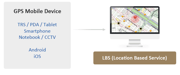
LBS (Location Based Service)
System that provides the location of the response resources (vehicles and persons) via the GPS of their mobile devices
LBS functions
- Location monitoring module
-
- Monitoring the location of the GPS Devices on the map in real time.
- Provides various tools on the map, including POI (point of interest), distance calculation, route options, search on map, etc.
- Find POI near vehicle (search and monitoring)
- Geo-fence control: Status such as Enter, Leaving, In, Out
- Geo-time-fence control: Status such Early, Lately, Enter, Leaving
- Geo-fence alert: Send event alert from selected location such as Enter, Leaving, In, Out
- Geo-time-fence alert: Send event alert from selected location for limited time such as Enter, Leaving , Early, Lately
- GPS device warning such as No Signal, No Movement
- Displays location information in real time via the GPS of various types of devi
- Integration with CTS, ARS, CAD, MRS on the map
- Statistical information
-
- Statistics for distance covered and search for path of device GPS systems
Features
- Supports GPS systems of various mobile devices: Easy extension by means of additional adapter
- Supports Geo-time analyses of response resources based on their location, which generate alerts for monitoring purposes
- Supports integration with other location based information systems such as CTS, ARS, CAD
- Easy configuration for increasing or decreasing the numbers of mobile devices
Supports quick decision making by the dispatcher for distribution of the dispatch order to the nearest resources
© WINITECH Co., Ltd All right reserved
(Bon-dong, Daegu Technical University, Welfare center 2F), 205, Songhyeon-ro, Dalseo-gu, Daegu, Korea
Tel : 82-53-659-1700FAX : 82-53-659-1707